


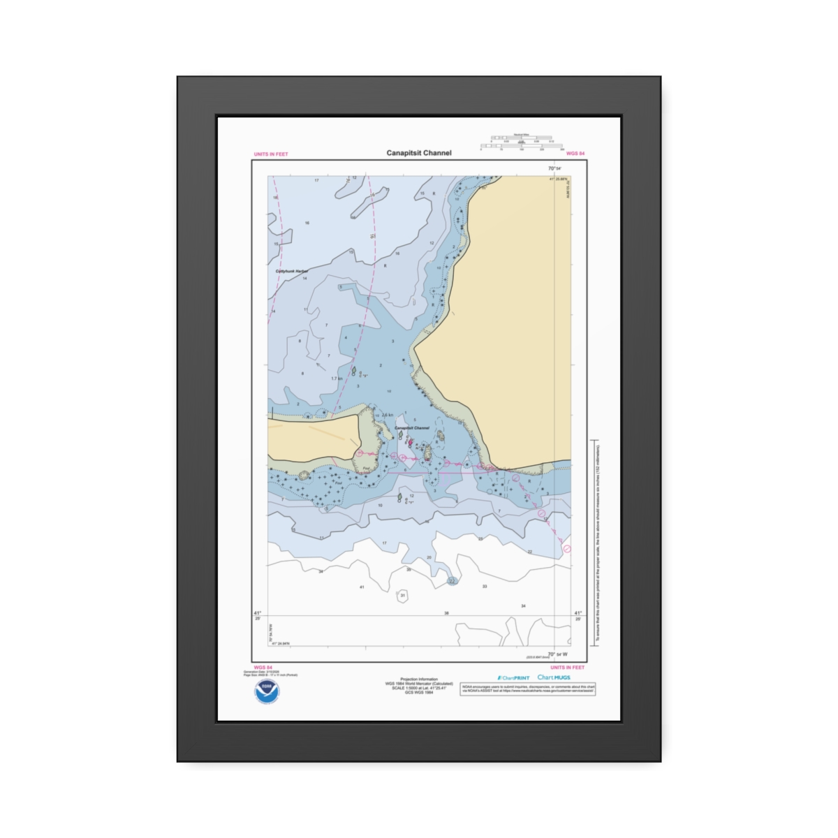
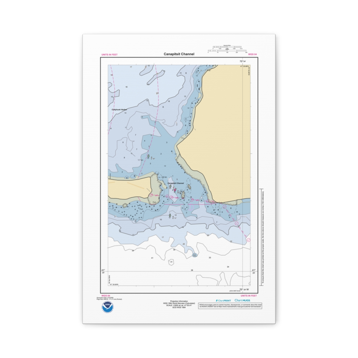
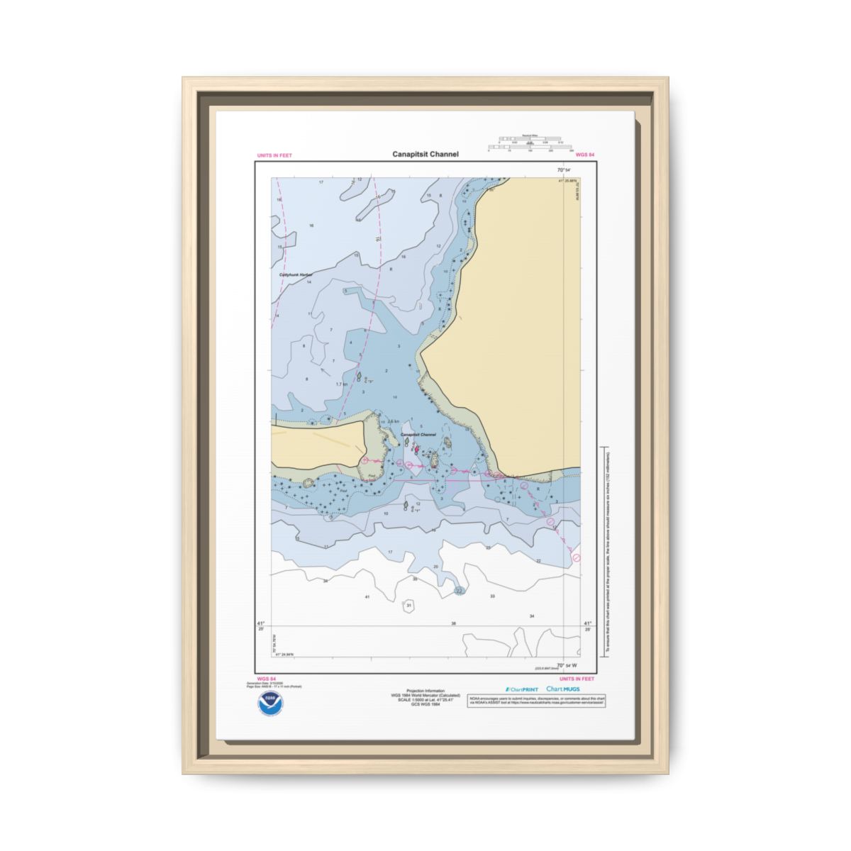
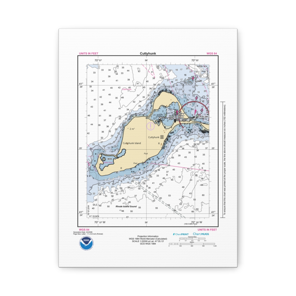
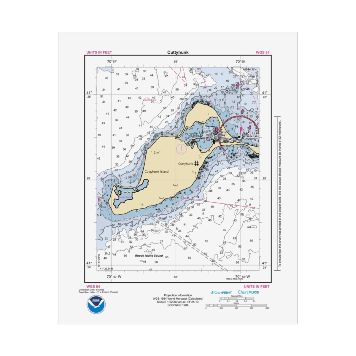
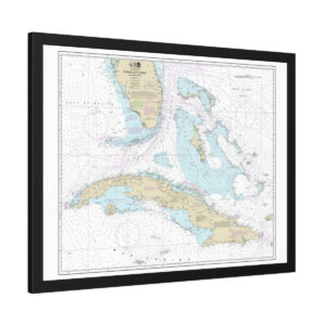
Nautical Chart of Canapitsit Channel
A personalized Canapitsit Channel nautical chart printed at 1:5,000 scale from official NOAA ENC data. Close enough to see individual docks, moorings, and channel markers. Every depth sounding and navigation aid around Canapitsit Channel is plotted. Built from NOAA’s current Electronic Navigational Chart (ENC) data — the vector-based format that replaced traditional paper charts and is now the official standard for US nautical navigation. Size: 12″ x 18″ (Vertical).
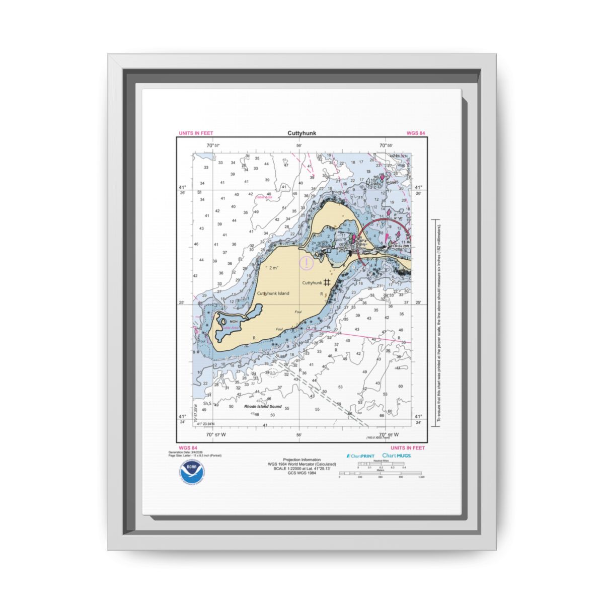
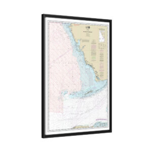
Your Canapitsit Channel Nautical Chart Poster
Your custom chart of Canapitsit Channel reproduced as a giclée print on premium paper — fine art for a textured archival feel, semi-glossy for vivid photo-sharp color, or matte for a clean understated look. The detail holds up to close inspection — fine linework, accurate depth coloring, and the precision that rewards a second look. Arrives rolled in a protective tube, ready to frame your way.
Choose Your Finish
Three Paper Finishes

Fine Art
Soft textured surface like traditional watercolor paper. Archival quality that lasts.
Semi-Glossy
Bright white satin photo paper. Full sharp color fidelity for vivid chart detail.
Matte
Lighter weight, non-reflective surface. Clean look, ideal for framing behind glass.
Lasting Color & Detail
Giclée printing produces bright, intense colors calibrated to match the original NOAA ENC data. Unlike standard prints, these inks resist fading from regular sunlight exposure — the nautical detail on your Canapitsit Channel chart stays vivid for years.
Giclée Print
Sunlight-resistant inks that won’t fade over time
Three Papers
Fine art, semi-glossy, or matte finish
Protective Tube
Ships rolled in a cardboard shipping tube
Free Shipping
Every order ships free within the US


Official Electronic Navigational Chart Data
This nautical chart poster of Canapitsit Channel is built from NOAA’s current Electronic Navigational Chart data — more precise and up-to-date than the traditional paper charts it replaced. Whether it’s for your wall or as a nautical gift, it captures Canapitsit Channel in a way no photograph can.
- Chart Source: Official NOAA ENC data
- Scale: 1:5,000 — harbor detail
- Print Size: 12″ x 18″ (Vertical)
- Format: Rolled Poster
- Paper: Three options — fine art, semi-glossy, or matte
- Print: Giclée — sunlight-resistant inks
- Shipping: Free on all orders
Common Questions
Frequently Asked Questions
Which paper should I choose?
How does the poster ship?
Will the colors fade?
Is this chart suitable for navigation?
If the print gathers dust, wipe gently with a clean, dry cloth.
Create a Custom Chart
Create another custom nautical chart from any US waterway using the latest NOAA ENC data.
Chart Notes Preview
Canapitsit Channel
Generation Date: 3/15/2026
Page 2
NOAA CUSTOM CHART
NOTES GEOSPATIAL DATABASE
VERSION 3.0B - 20 FEBRUARY 2025
The records of the NOAA Custom
Chart Notes Geospatial Database are
current as of February 20, 2025.
Subsequent additions and refinements
are to be expected. Please refer to
all
available
navigational
publications for complete information
about the charted area.
CAUTION
AUTOMATED CHART GENERATION
This NOAA Custom Chart has been
automatically
rendered
from
NOAA
Electronic Navigational Chart (NOAA
ENC®) data. Mariners using this NOAA
Custom Chart are advised that this is
a static reproduction of the NOAA
ENC®. This NOAA Custom Chart has not
been individually quality checked or
adjusted
for
optimal
use
for
navigation. The portrayal may be at a
different scale from that of the
original NOAA ENC®. Mariners are
advised to use caution when using
this NOAA Custom Chart for navigation
and are encouraged to use the latest
NOAA ENC® to access the most up-to-
date information. Mariners must also
comply with all applicable regulatory
requirements.
CAUTION
CHART UPDATES
This NOAA Custom Chart contains up-
to-date information only as of the
time of creation, and will become
outdated. Mariners are advised to
visit
https://
distribution.charts.noaa.gov/
navigation-updates/
to
check
for
critical and routine updates, and to
render a new NOAA Custom Chart when
the ENC data used to make the chart
is updated. Notices to Mariners are
not issued for corrections to this
NOAA Custom Chart.
HEIGHTS
Heights of fixed aids to navigation
and vertical clearances of overhead
obstructions will be shown in feet if
the units are set to feet or fathoms.
If units are set to meters, heights
will
be
shown
in
meters.
Land
elevation values are shown in meters
only.
AUTHORITIES
Hydrography and topography by the
National Ocean Service, Coast Survey,
with additional data from the Corps
of Engineers, Geological Survey, U.S.
Coast Guard and National Geospatial-
Intelligence Agency.
WATER LEVELS, CURRENTS, AND TIDES
Real-time
water
levels,
tide
predictions,
and
tidal
current
predictions are available on the
internet
from
NOAA’s
Center
for
Operational
Oceanographic
Products
and Services (CO-OPS) at https://
tidesandcurrents.noaa.gov/
water_level_info.html
and
https://
tidesandcurrents.noaa.gov/
currents_info.html .
COMMENTS REQUESTED
NOAA encourages users to submit
inquiries, discrepancies, or comments
about this chart via NOAA's ASSIST
tool
at
https://
nauticalcharts.noaa.gov/customer-
service/assist/ .
ABBREVIATIONS
For complete list of Symbols and
Abbreviations, see Chart No. 1.
Canapitsit Channel
Generation Date: 3/15/2026
Page 3
POLLUTION REPORTS
Report all spills of oil and
hazardous substances to the National
Response Center via 1-800-424-8802
(toll free), or to the nearest U.S.
Coast Guard facility if telephone
communication is impossible (33 CFR
153).
AIDS TO NAVIGATION
Consult U.S. Coast Guard Light List
for
supplemental
information
concerning aids to navigation.
RADAR REFLECTORS
Radar reflectors have been placed
on many floating aids to navigation.
Individual
radar
reflector
identification on these aids has been
omitted from this chart.
WARNING
The prudent mariner will not rely
solely
on
any
single
aid
to
navigation, particularly on floating
aids. See U.S. Coast Guard Light List
and U.S. Coast Pilot for details.
ADDITIONAL INFORMATION
Additional information can be
obtained
at
www.nauticalcharts.noaa.gov
SUPPLEMENTAL INFORMATION
Consult U.S. Coast Pilot 2 for
important supplemental information.
Refer to charted regulation section
numbers.
SOUNDING DATUM
Soundings referred to Mean Lower
Low Water (MLLW).
VERTICAL DATUM
Overhead clearances are referred to
Mean High Water (MHW).
NOTE A
Navigation
regulations
are
published in Chapter 2, U.S. Coast
Pilot 2. Additions or revisions to
Chapter
2
are
published
in
the
Notices
to
Mariners.
Information
concerning the regulations may be
obtained
at
the
Office
of
the
Commander, 1st Coast Guard District
in Boston, MA or at the Office of the
District Engineer, Corps of Engineers
in Concord, MA.
Refer to charted regulation section
numbers.
COLREGS DEMARCATION LINE
The Inland Navigational Rules Act
of 1980 is in effect for vessels
transiting this area. The seaward
boundaries of this area are the
COLREGS demarcation lines. In the
area
seaward
of
the
COLREGS
demarcation
lines,
vessels
are
governed by COLREGS: International
Regulations for Preventing Collisions
at Sea, 1972. The COLREGS demarcation
line is defined in COLREGS 33 CFR
80.145b.
Canapitsit Channel
Generation Date: 3/15/2026
Page 4
CAUTION
LIMITATIONS ON THE
USE OF RADIO SIGNALS
Limitations on the use of radio
signals as aids to marine navigation
can be found in the U.S. Coast Guard
Light Lists and National Geospatial-
Intelligence Agency Publication 117.
Radio direction-finder bearings to
commercial broadcasting stations are
subject to error and should be used
with caution.
CAUTION
FISH TRAP AREAS
Uncharted
stakes,
piles
and,
fishing structures, some submerged,
may exist within this area.
CAUTION
SUBMERGED CABLES AND PIPELINES
Additional uncharted submarine
pipelines and submarine cables may
exist within the area of this chart.
Not
all
submarine
pipelines
and
submarine cables are required to be
buried,
and
those
that
were
originally buried may have become
exposed. Mariners should use extreme
caution when operating vessels in
depths of water comparable to their
draft in areas where pipelines and
cables may exist, and when anchoring,
dragging or trawling.
Covered wells may be marked by
lighted or unlighted buoys.
CAUTION
USACE conducts hydrographic surveys
to
monitor
navigation
conditions.
These surveys are not intended to
detect underwater features. Uncharted
features
hazardous
to
surface
navigation are not expected but may
exist in federal channels. For more
information
visit
https://
navigation.usace.army.mil/Survey/
Hydro.
CAUTION
Temporary changes or defects in
aids to navigation are not indicated
on this chart. See Local Notice to
Mariners.
During some winter months or when
endangered by ice, certain aids to
navigation are replaced by other
types or removed. For details, see
U.S. Coast Guard Light List.
NOTE Z
NO-DISCHARGE ZONE, 40 CFR 140
Under the Clean Water Act, Section
312, all vessels operating within a
No-Discharge
Zone
(NDZ)
are
completely
prohibited
from
discharging any sewage, treated or
untreated,
into
the
waters.
All
vessels with an installed marine
sanitation device (MSD) that are
navigating,
moored,
anchored,
or
docked within a NDZ must have the MSD
disabled to prevent the overboard
discharge
of
sewage
(treated
or
untreated) or install a holding tank.
Regulations for the NDZ are contained
in the U.S. Coast Pilot. Additional
information
concerning
the
regulations and requirements may be
obtained
from
the
Environmental
Protection
Agency
(EPA)
website:
https://www.epa.gov/vessels-marinas-
and-ports .
NOAA WEATHER RADIO BROADCASTS
The NOAA Weather Radio station
listed
below
provides
continuous
weather
broadcasts.
The
reception
range is typically 20 to 40 nautical
miles from the antenna site, but can
be as much as 100 nautical miles for
stations at high elevations.
Boston, MA KHB-35 162.475 MHz
Canapitsit Channel
Generation Date: 3/15/2026
Page 5
NOAA WEATHER RADIO BROADCASTS
The NOAA Weather Radio station
listed
below
provides
continuous
weather
broadcasts.
The
reception
range is typically 20 to 40 nautical
miles from the antenna site, but can
be as much as 100 nautical miles for
stations at high elevations.
Bourne/Hyannis, MA KEC-73 162.550 MHz
Reviews
There are no reviews yet.