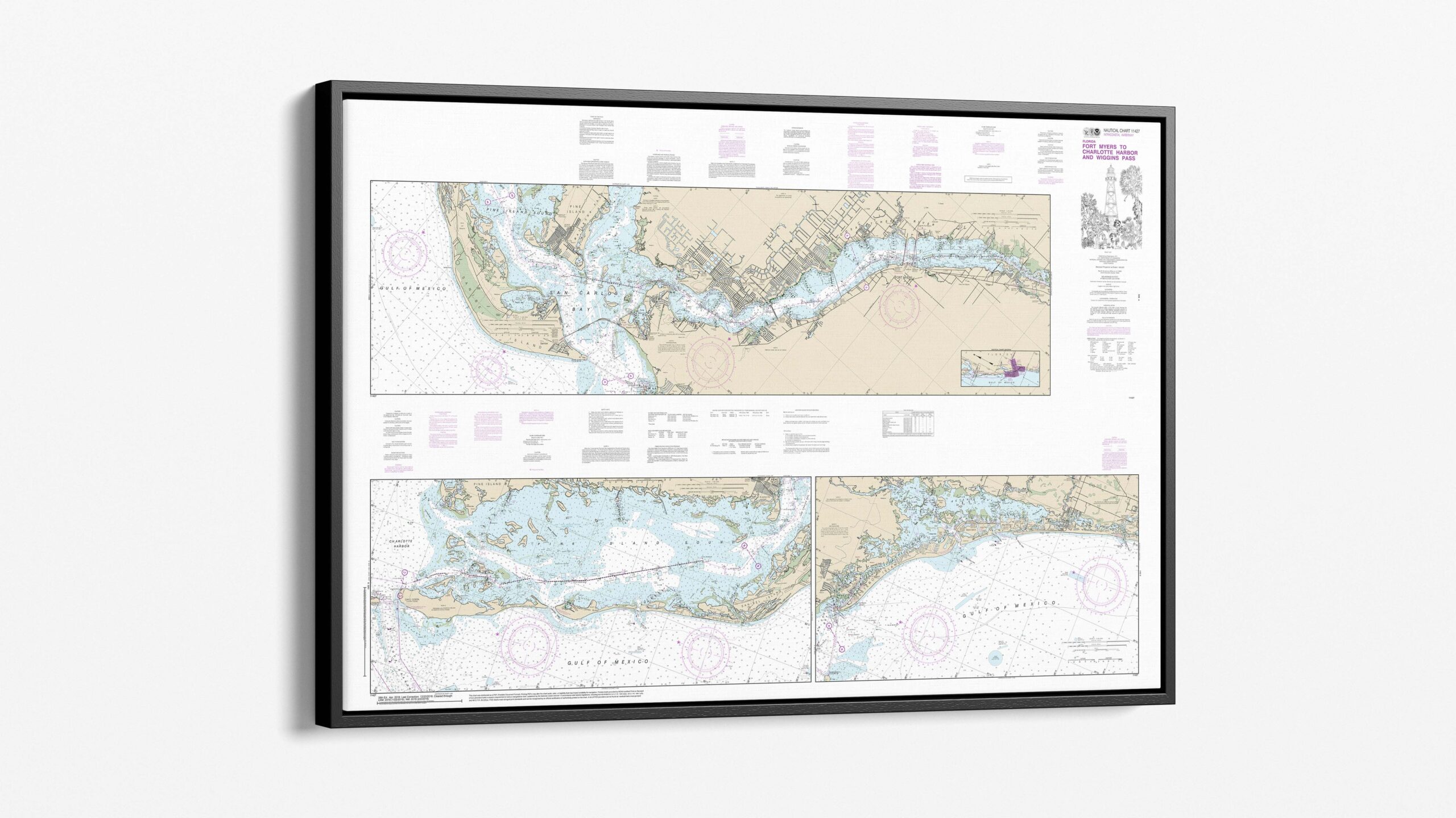
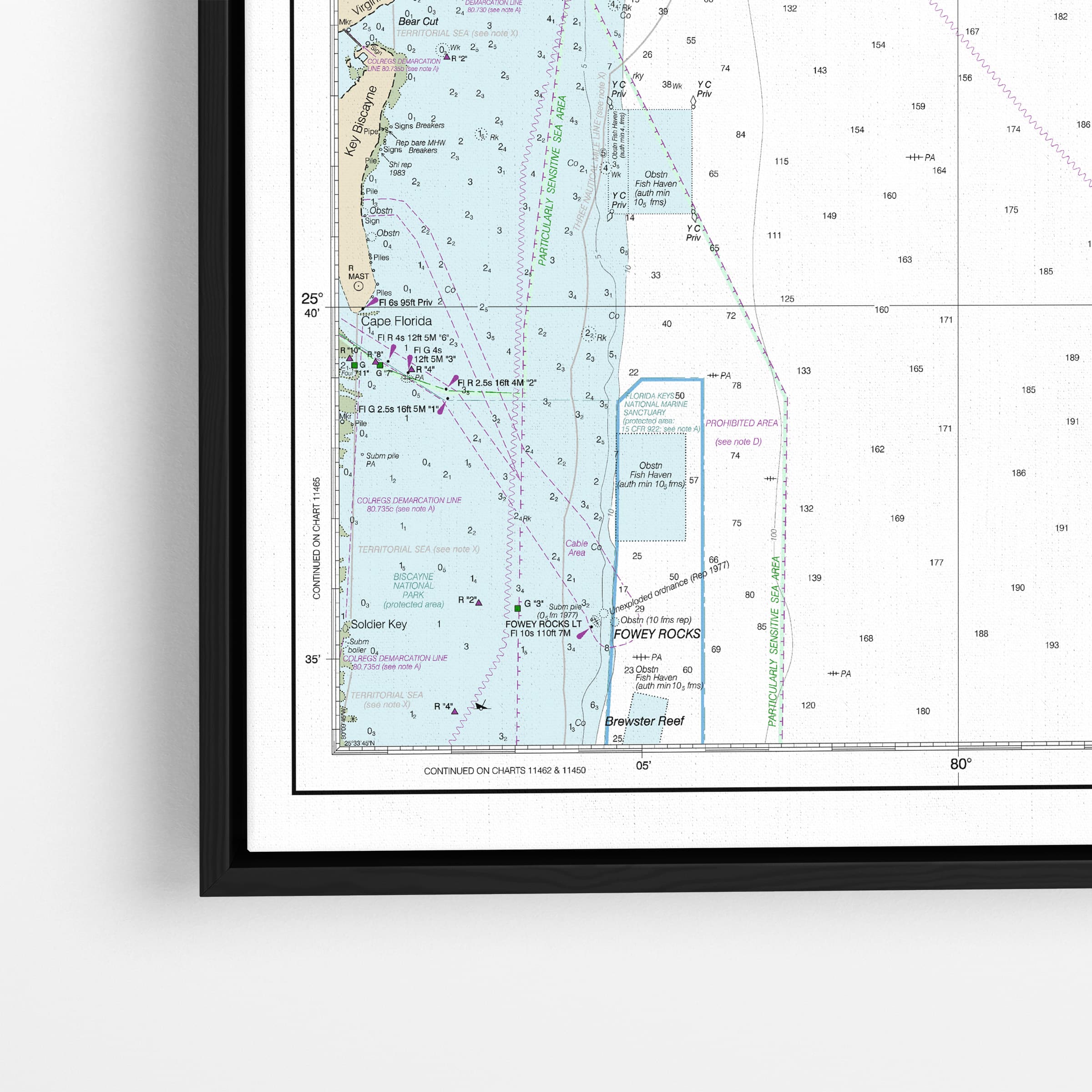
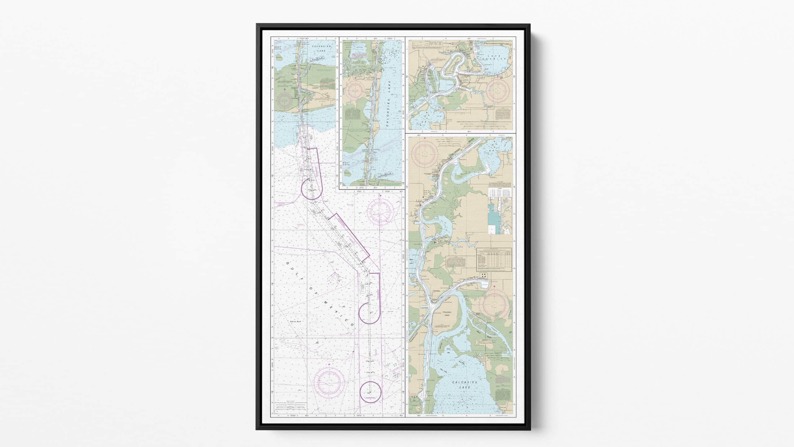
Framed Charts
Nautical charts on fine art or gloss paper & gallery canvas wraps
Choose between framed or unframed options to suit your needs. Display a piece of history from the newly retired NOAA Raster Nautical Chart Collection
Immerse yourself with our premium selection carefully crafted with precision on fine art paper, glossy paper, or gallery canvas, our prints are available in a variety of large formats to fit any space.
Choose from four stylish finish options with sizes up to 48″
Floating Frame Canvas
-
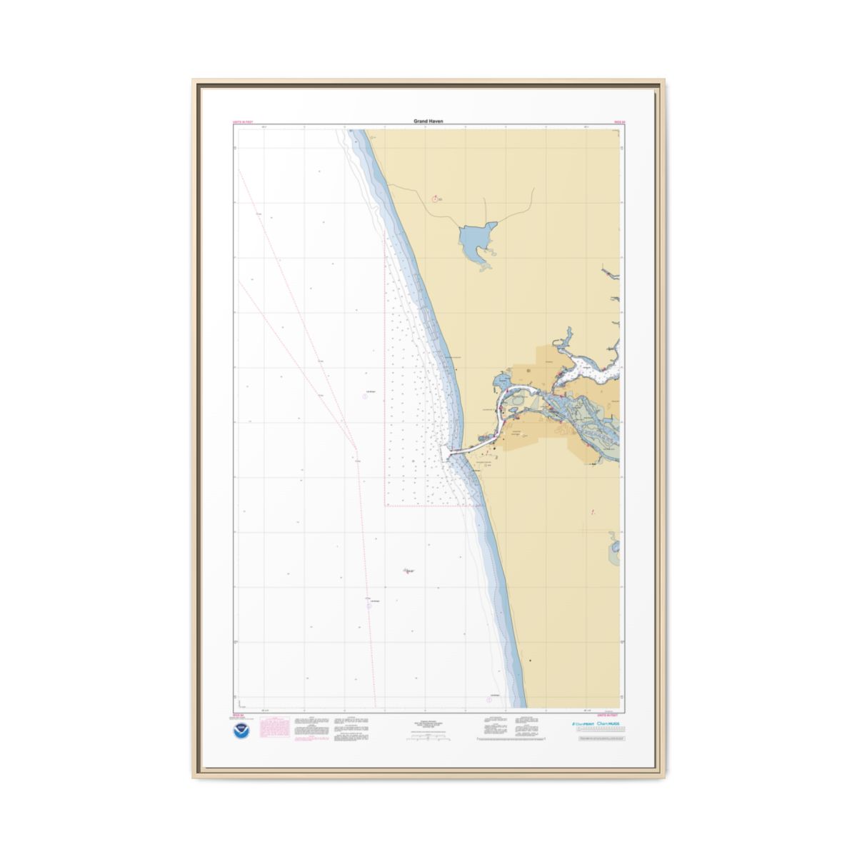 Canvas Framed Custom Chart of Grand Haven – NOAA Nautical Chart 40″ x 60″ (Vertical)$494.95
 -
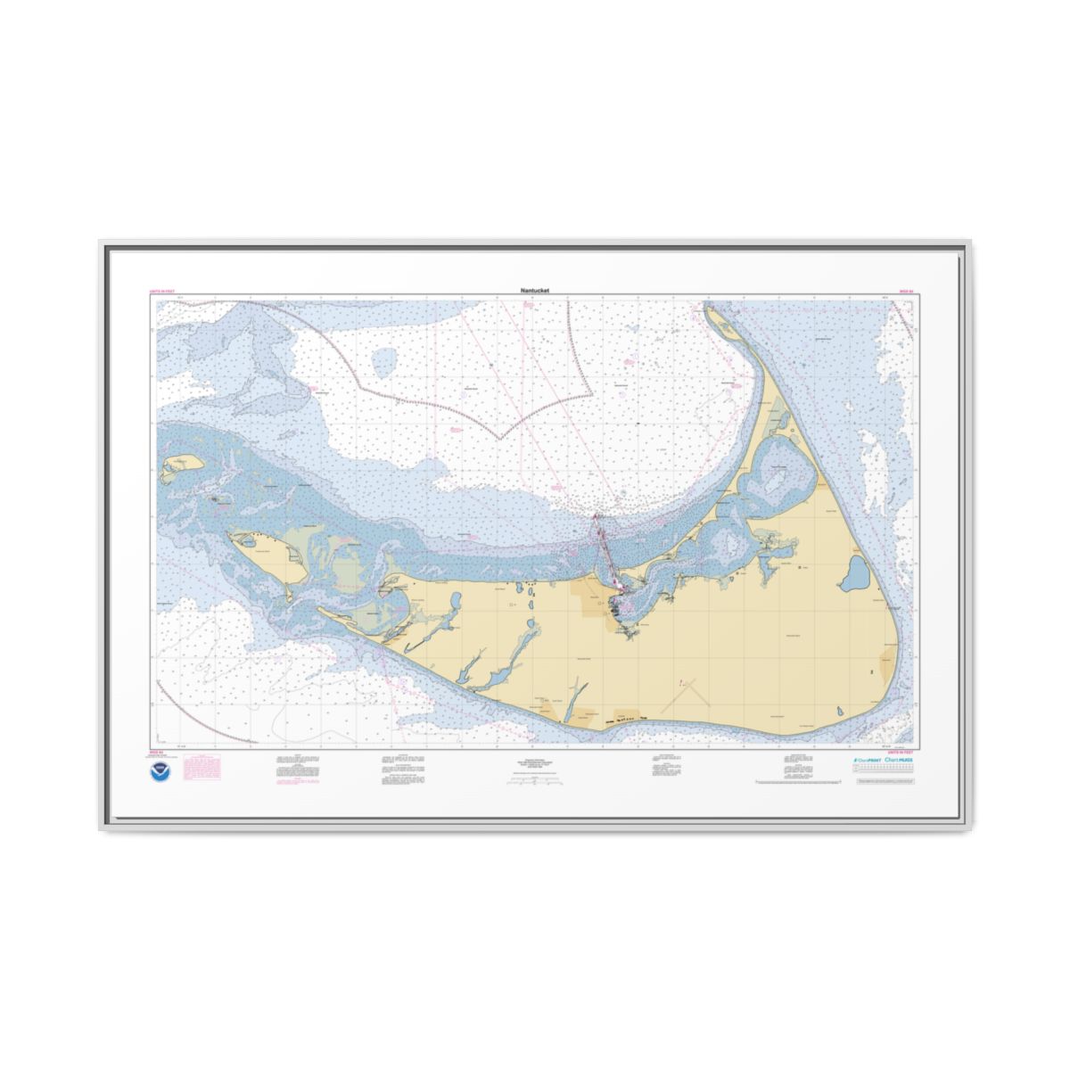 Canvas Framed Custom Chart of Nantucket – NOAA Nautical Chart 60″ x 40″ (Horizontal)$494.95
 -
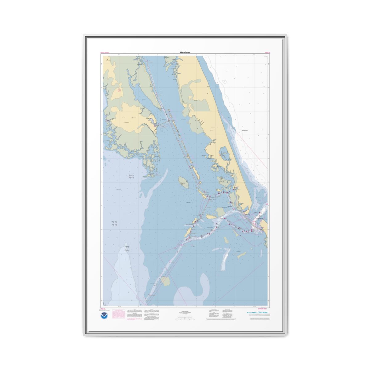 Canvas Framed Custom Chart of Wanchese – NOAA Nautical Chart 40″ x 60″ (Vertical)$494.95
 -
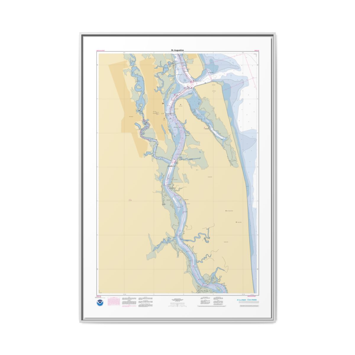 Canvas Framed Custom Chart of St. Augustine – NOAA Nautical Chart 40″ x 60″ (Vertical)$494.95
Framed Paper Print
-
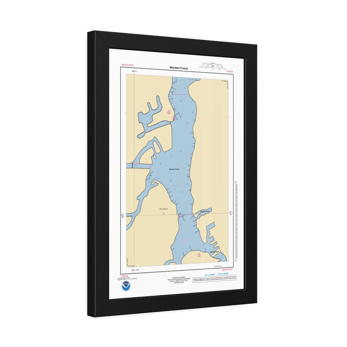 Framed Custom Chart of Manatee Pocket – NOAA Nautical Chart 12″ x 18″ (Vertical)$134.95 – $164.95
 -
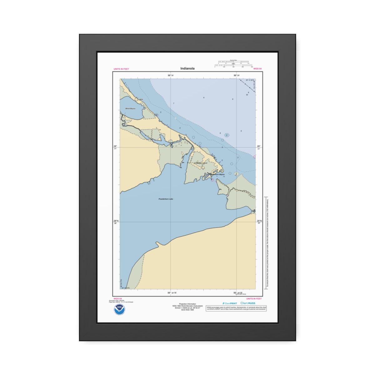 Framed Custom Chart of Indianola – NOAA Nautical Chart 12″ x 18″ (Vertical)$134.95 – $164.95
 -
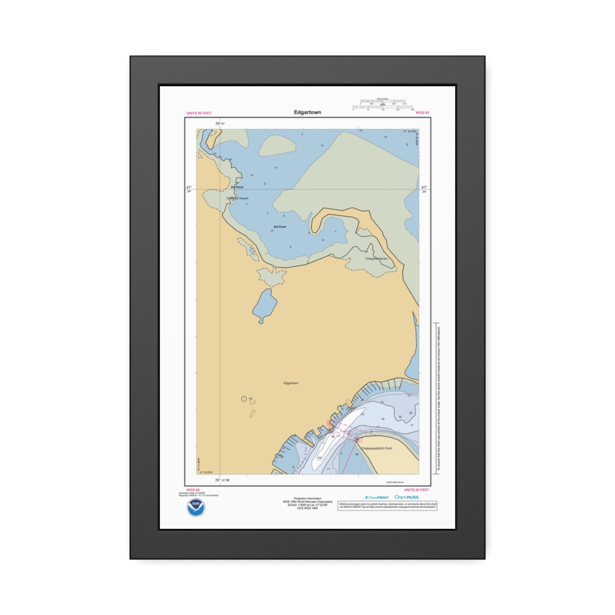 Framed Custom Chart of Edgartown – NOAA Nautical Chart 12″ x 18″ (Vertical)$134.95 – $164.95
 -
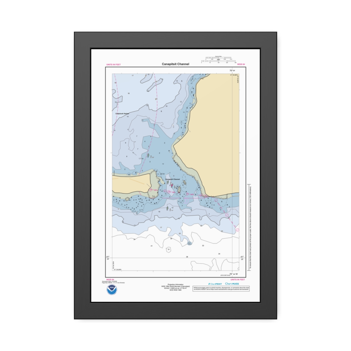 Framed Custom Chart of Canapitsit Channel – NOAA Nautical Chart 12″ x 18″ (Vertical)$134.95 – $164.95
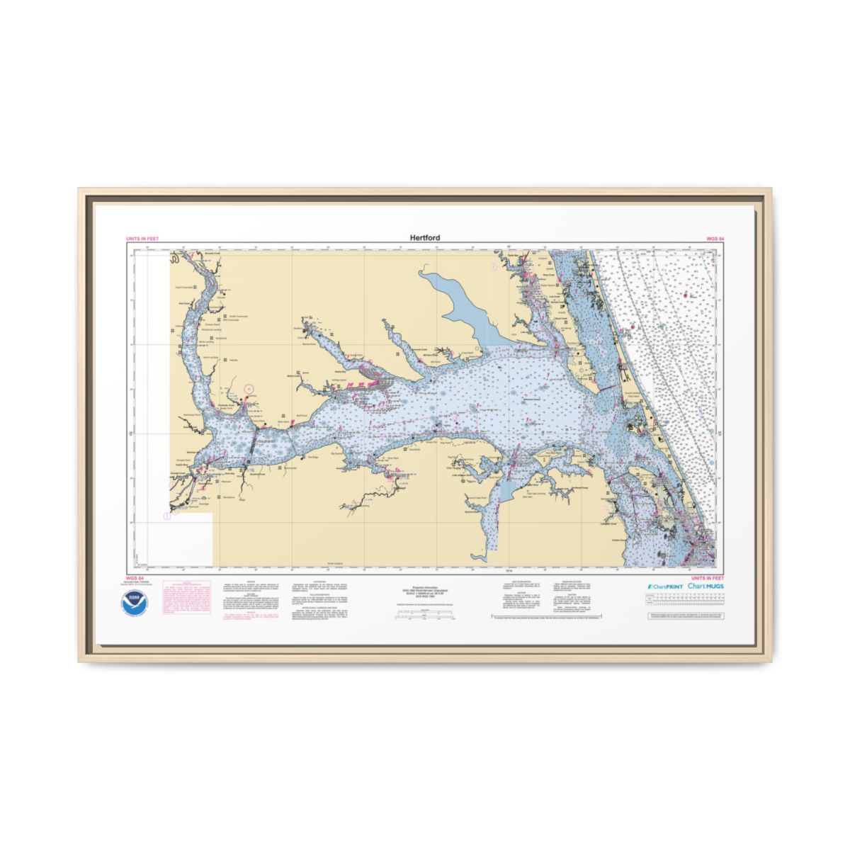
Gallery Wrapped Canvas
-
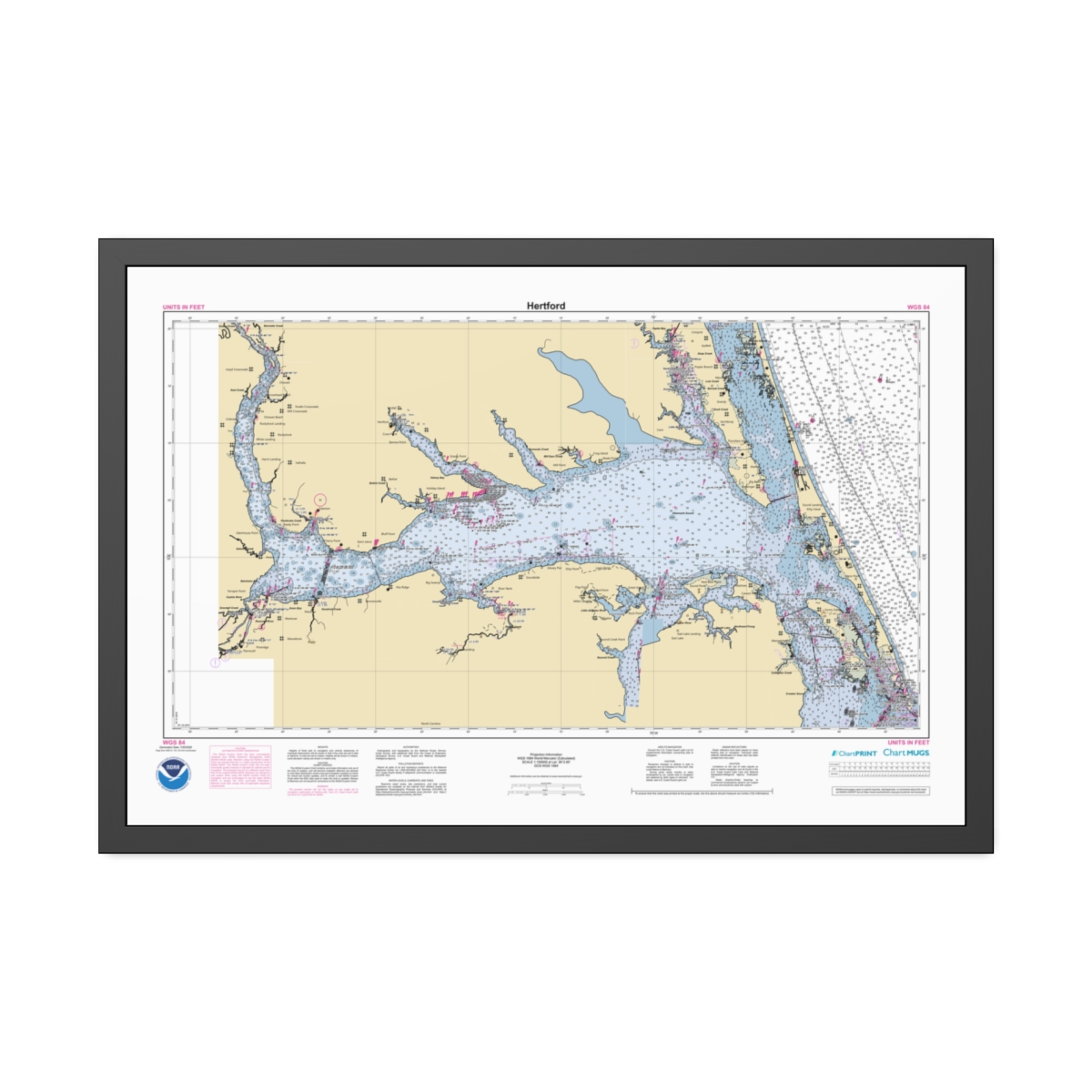
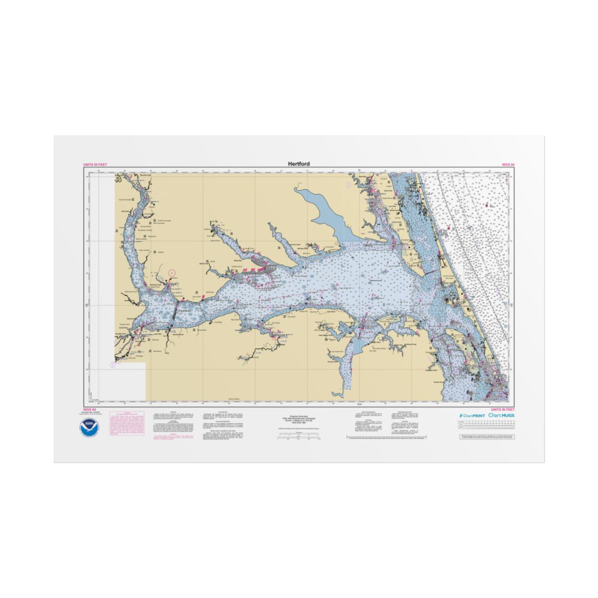
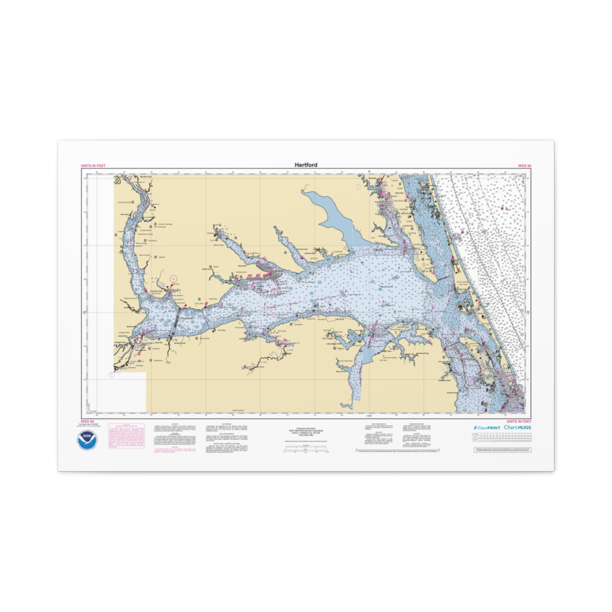 Canvas Custom Chart of Hertford – NOAA Nautical Chart 36″ x 24″ (Horizontal)$184.95
 -
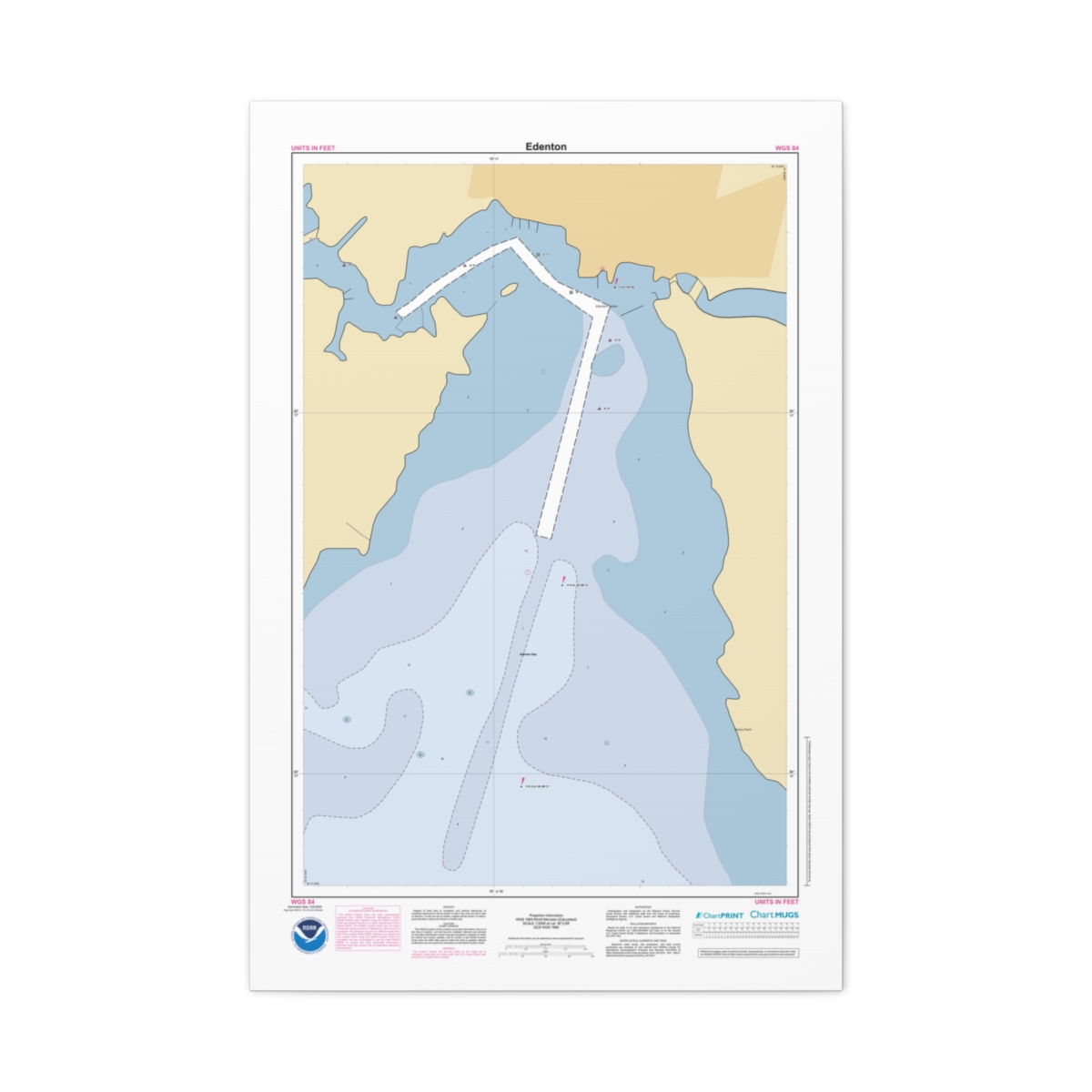 Canvas Custom Chart of Edenton – NOAA Nautical Chart 24″ x 36″ (Vertical)$184.95
 -
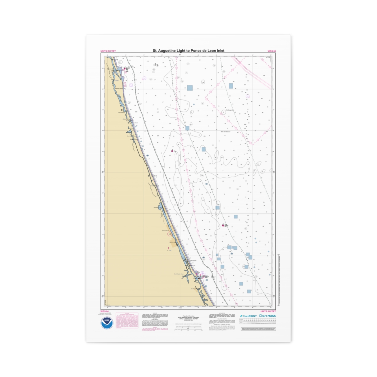 Canvas Custom Chart of St. Augustine Light to Ponce de Leon Inlet – NOAA Nautical Chart 24″ x 36″ (Vertical)$184.95
 -
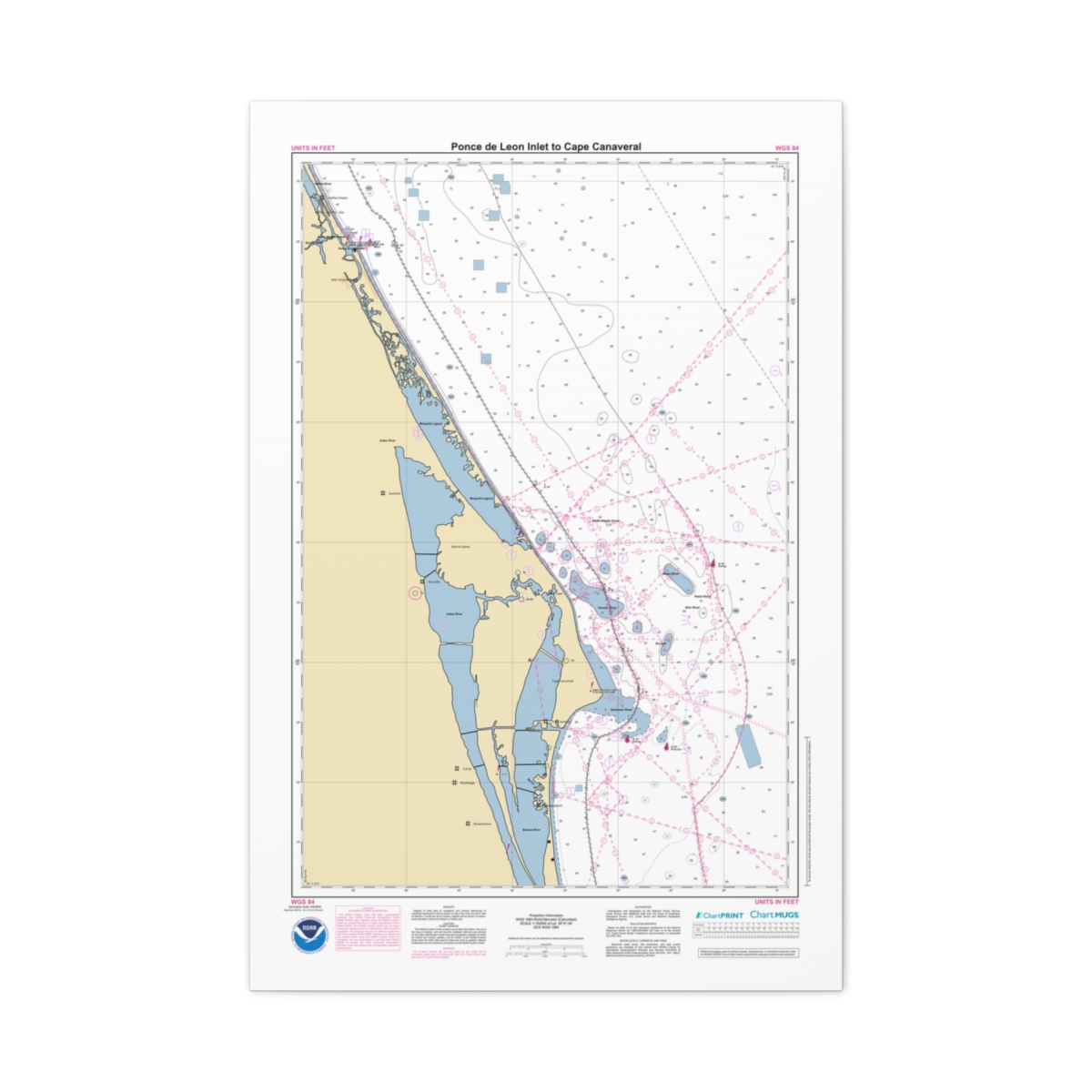 Canvas Custom Chart of Ponce de Leon Inlet to Cape Canaveral – NOAA Nautical Chart 24″ x 36″ (Vertical)$184.95
Fine Art Rolled Poster Print
-
 Custom Chart of Grand Haven – NOAA Nautical Chart 40″ x 60″ (Vertical)$124.95
 -
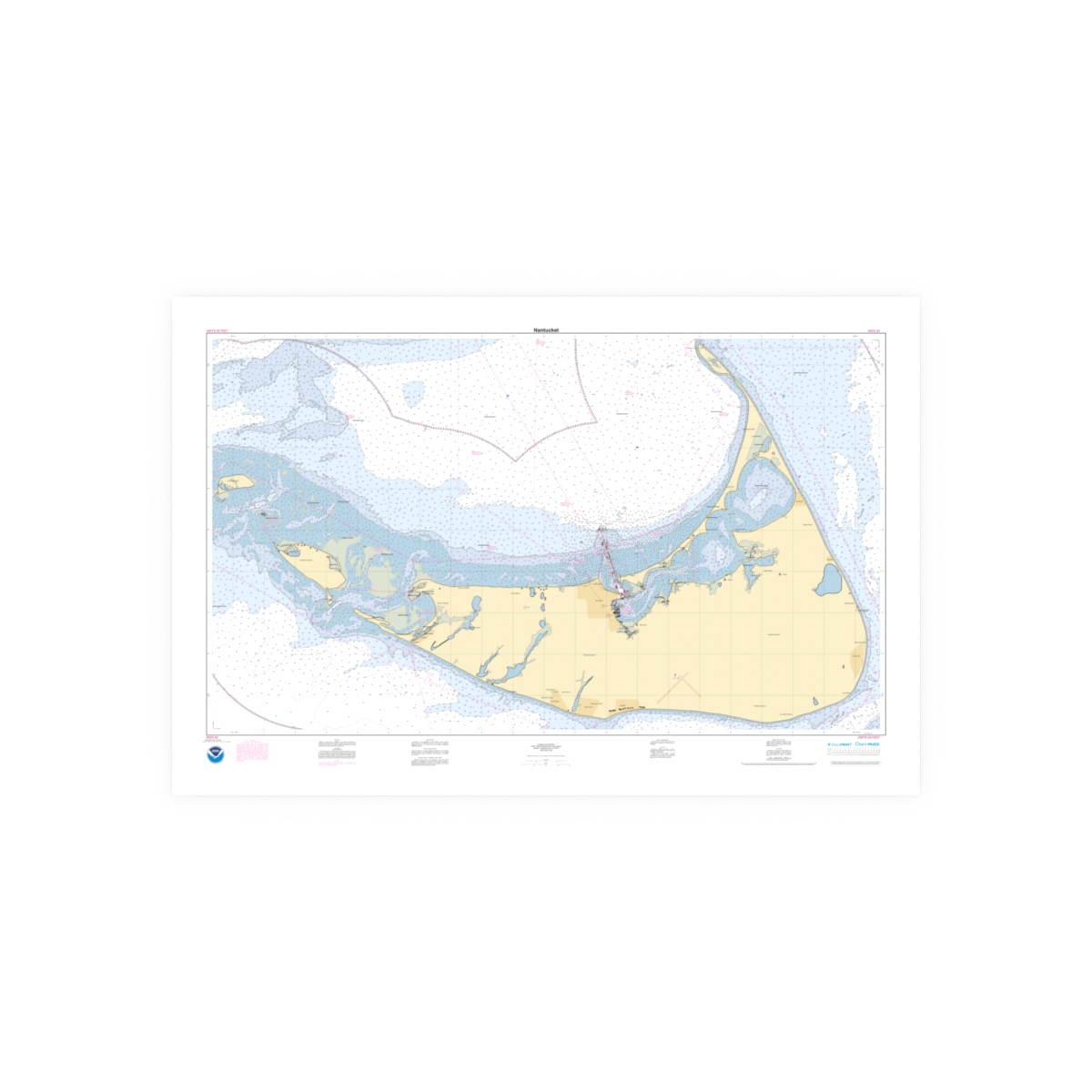 Custom Chart of Nantucket – NOAA Nautical Chart 60″ x 40″ (Horizontal)$124.95
 -
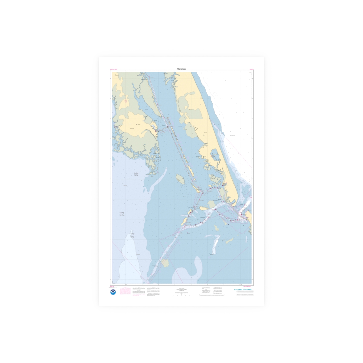 Custom Chart of Wanchese – NOAA Nautical Chart 40″ x 60″ (Vertical)$124.95
 -
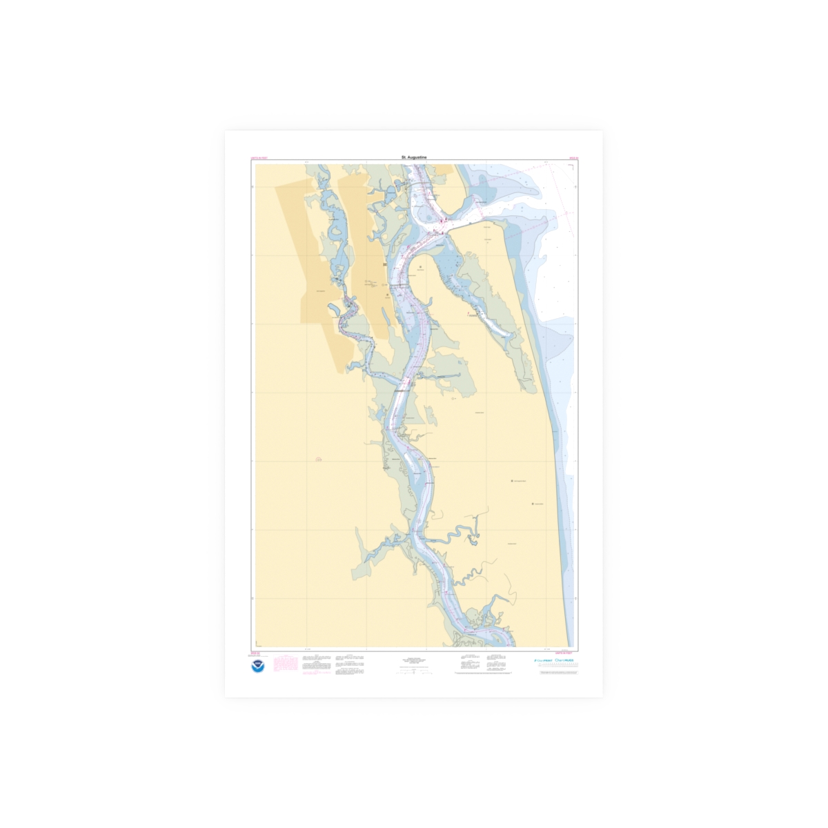 Custom Chart of St. Augustine – NOAA Nautical Chart 40″ x 60″ (Vertical)$124.95